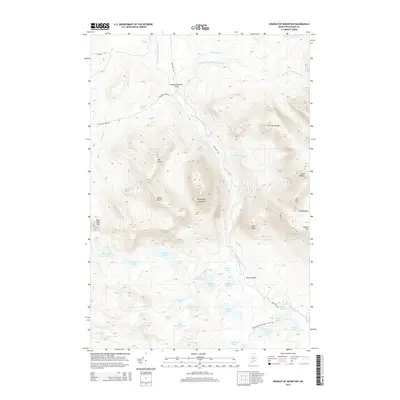
2014 Map of Doubletop Mountain
USGS Topo · Published 2014About this map
Doubletop Mountain dominates this portion of the Maine wilderness, serving as a central hub for a complex network of glacial ponds and drainage streams. The area is defined by the Nesowadnehunk Stream valley, which provides a corridor for the Park Tote Rd and access to established clearings like Nesowadnehunk Field and Foster Field. The southern extent of the map features a high concentration of water bodies, including Kidney Pond, Daicey Pond, and Elbow Pond, several of which are intersected by the Appalachian National Scenic Trail.
Find a feature on this map
44 named features on this map. Tap any name to fly to it.
Don’t see what you’re looking for? This feature index may not catch every label — zoom into the map to look around manually.
Map Details
Editions of this 2014 Doubletop Mountain Map
This is the sole edition of this map. No revisions or reprints were ever made.
Other maps of this area

1927 · Katahdin
USGS Topo · 1:48,000

1930 · Katahdin
USGS Topo · 1:62,500

1949 · Katahdin
USGS Topo · 1:62,500

1953 · Telos Lake
USGS Topo · 1:62,500

1954 · Harrington Lake
USGS Topo · 1:62,500

1954 · Presque Isle
USGS Topo · 1:250,000

1954 · Millinocket
USGS Topo · 1:250,000

1955 · Traveler Mountain
USGS Topo · 1:62,500

1957 · Telos Lake
USGS Topo · 1:62,500

1958 · Presque Isle
USGS Topo · 1:250,000