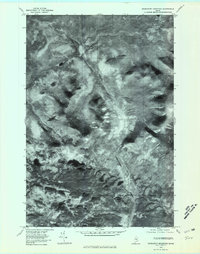
1978 Map of Doubletop Mountain
USGS Topo · Published 1981About this map
Nesowadnehunk Stream carves a dominant path through this portion of the Maine wilderness, as documented in an aerial orthophotograph from the late 1970s. The landscape is defined by high-elevation peaks including Doubletop Mountain, Mount Veto, Mount Coe, and the distinctly named Mount O-J-I. This photographic survey provides a rare view of the forest canopy and drainage patterns before modern digital mapping, showing the specific relationship between the granite heights and the basin containing Kidney Pond and Slaughter Pond. The orthophoto format reveals the texture of the timber and the sharp vertical relief of the mountainsides in a way that standard topographic lines often obscure, capturing the raw state of this Piscataquis County terrain during a single October day in 1978.
Find a feature on this map
7 named features on this map. Tap any name to fly to it.
Don’t see what you’re looking for? This feature index may not catch every label — zoom into the map to look around manually.
Map Details
Editions of this 1978 Doubletop Mountain Map
This is the sole edition of this map. No revisions or reprints were ever made.
Other maps of this area

1927 · Katahdin
USGS Topo · 1:48,000

1930 · Katahdin
USGS Topo · 1:62,500

1949 · Katahdin
USGS Topo · 1:62,500

1953 · Telos Lake
USGS Topo · 1:62,500

1954 · Harrington Lake
USGS Topo · 1:62,500

1954 · Presque Isle
USGS Topo · 1:250,000

1954 · Millinocket
USGS Topo · 1:250,000

1955 · Traveler Mountain
USGS Topo · 1:62,500

1957 · Telos Lake
USGS Topo · 1:62,500

1958 · Presque Isle
USGS Topo · 1:250,000