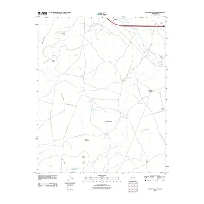
2010 Map of Dough Mountain
USGS Topo · Published 2010About this map
South Laguna Mines sit at the northern edge of this high-desert landscape, where the geology of the Colorado Plateau meets historical land use. The map reveals a network of Bureau of Indian Affairs routes, such as Indian Service Route 491 and Indian Service Route 543, connecting isolated settlements and livestock locations. Key points of habitation and work include the small community of El Rito, the sheep ranching site at Kose Sheep Camp, and the settlement of Schro Gana near the Rio San Jose.
Find a feature on this map
36 named features on this map. Tap any name to fly to it.
Don’t see what you’re looking for? This feature index may not catch every label — zoom into the map to look around manually.
Map Details
Editions of this 2010 Dough Mountain Map
This is the sole edition of this map. No revisions or reprints were ever made.
Other maps of this area

1883 · Mt. Taylor
USGS Topo · 1:250,000

1886 · Mt. Taylor
USGS Topo · 1:250,000

1892 · Mt. Taylor
USGS Topo · 1:250,000

1899 · Mt. Taylor
USGS Topo · 1:250,000

1917 · Cerro Verde
USGS Topo · 1:125,000

1954 · Socorro
USGS Topo · 1:250,000

1956 · South Garcia
USGS Topo · 1:62,500

1957 · Laguna
USGS Topo · 1:24,000
1957 · Mesa Gigante
USGS Topo · 1:24,000

1957 · Mesita
USGS Topo · 1:24,000