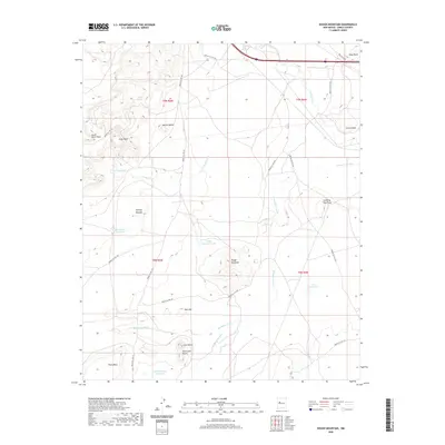
2020 Map of Dough Mountain
USGS Topo · Published 2020About this map
Dough Mountain and the surrounding volcanic terrain dominate this portion of Cibola County, where the landscape is defined by high mesas and distinct igneous features. The area around Mesita Blanca and Schro Gana showcases a series of prominent elevations, including South Point Mesa, Crow Mesa, and the volcanic profiles of Lava Butte and South Lava Butte. This high-desert geography is crosscut by numerous Indian Service Routes, such as Indian Svc Rte 491 and Indian Svc Rte 541, which provide the primary access through the dry washes and rolling mounds.
Find a feature on this map
34 named features on this map. Tap any name to fly to it.
Don’t see what you’re looking for? This feature index may not catch every label — zoom into the map to look around manually.
Map Details
Editions of this 2020 Dough Mountain Map
This is the sole edition of this map. No revisions or reprints were ever made.
Other maps of this area

1883 · Mt. Taylor
USGS Topo · 1:250,000

1886 · Mt. Taylor
USGS Topo · 1:250,000

1892 · Mt. Taylor
USGS Topo · 1:250,000

1899 · Mt. Taylor
USGS Topo · 1:250,000

1917 · Cerro Verde
USGS Topo · 1:125,000

1954 · Socorro
USGS Topo · 1:250,000

1956 · South Garcia
USGS Topo · 1:62,500

1957 · Laguna
USGS Topo · 1:24,000
1957 · Mesa Gigante
USGS Topo · 1:24,000

1957 · Mesita
USGS Topo · 1:24,000