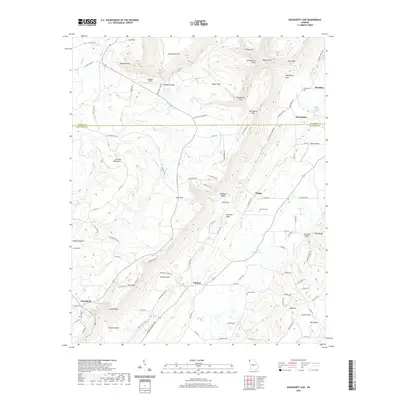
2020 Map of Dougherty Gap
USGS Topo · Published 2020About this map
Pigeon Mtn and Lookout Mountain define the high elevations of this corridor where the boundaries of Walker and Chattooga counties meet. The landscape is characterized by its deep, named gulfs and gaps, such as Dougherty Gap, Harrisburg Gulf, and Chelsea Gulf, which channel the movement of water and travel through the valley floors. At the base of these ridges, small settlements like Teloga and Chelsea are situated near vital water sources including Teloga Cr and Chelsea Cr. The agricultural and residential history of the area is anchored by local landmarks like Mcconels Bridge and family-associated burial sites including Hemphill Cem and Garrett Cem. Between McLemore Cove and Shinbone Valley, the map reveals a network of mountain roads and landings, including Hogjowl Airport and Wyatt Airport, that connected these relatively isolated upland communities.
Find a feature on this map
114 named features on this map. Tap any name to fly to it.
Don’t see what you’re looking for? This feature index may not catch every label — zoom into the map to look around manually.
Map Details
Editions of this 2020 Dougherty Gap Map
This is the sole edition of this map. No revisions or reprints were ever made.
Other maps of this area

1886 · Ringgold
USGS Topo · 1:125,000

1886 · Rome
USGS Topo · 1:125,000

1886 · Stevenson
USGS Topo · 1:125,000

1892 · Ringgold
USGS Topo · 1:125,000

1892 · Stevenson
USGS Topo · 1:125,000

1893 · Fort Payne
USGS Topo · 1:125,000

1895 · Stevenson
USGS Topo · 1:125,000

1898 · Rome
USGS Topo · 1:125,000

1898 · Fort Payne
USGS Topo · 1:125,000

1899 · Rome
USGS Topo · 1:125,000