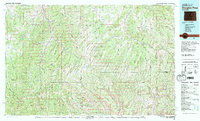
1981 Map of Douglas Pass
USGS Topo · Published 1982About this map
Douglas Pass serves as the central focal point of this high-altitude landscape in Western Colorado, where the crossing divides the drainages of Douglas Creek and the upper reaches of Texas Creek. The terrain is defined by the sharp escarpments of the Roan Plateau and the Cathedral Bluffs, illustrating the complex drainage patterns of the Piceance Basin during the early 1980s. A notable industrial presence is indicated by the Naval Oil Shale Reserve in the southeast, highlighting the region's historical importance to national energy interests. Localized water sources, critical for both ranching and early development, are mapped with precision, including Oil Spring, Wild Rose Spring, and Big Cedar Spring. To the west, Baxter Pass provides another high-elevation gateway, while named features like Lookout Mountain and Twin Buttes provide distinct landmarks across the ridgelines of Rio Blanco and Garfield counties.
Find a feature on this map
65 named features on this map. Tap any name to fly to it.
Don’t see what you’re looking for? This feature index may not catch every label — zoom into the map to look around manually.
Map Details
Editions of this 1981 Douglas Pass Map
This is the sole edition of this map. No revisions or reprints were ever made.
Other maps of this area

1885 · East Tavaputs
USGS Topo · 1:250,000

1885 · Ashley
USGS Topo · 1:250,000

1906 · Grand Hogback
USGS Topo · 1:125,000

1907 · Rangely
USGS Topo · 1:125,000

1907 · Jensen
USGS Topo · 1:125,000

1907 · White River
USGS Topo · 1:125,000

1910 · Danforth Hills
USGS Topo · 1:125,000

1910 · Jensen
USGS Topo · 1:125,000

1910 · Grand Hogback
USGS Topo · 1:125,000

1910 · White River
USGS Topo · 1:125,000