
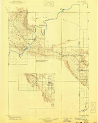
1910 Map of Jensen
USGS Topo · Published 1910About this map
Ashley Valley serves as the focal point for settlement in this 1907 reconnaissance survey of the High Uinta basin and the Colorado-Utah border. The hub of Vernal sits at the center of a developing grid, while the Green River carves a dramatic path through Split Mountain Canyon to the north. This survey documents the early transportation network of the era, specifically identifying two river ferries near the settlement of Jensen and the Dragon Stage Road heading south.
Find a feature on this map
27 named features on this map. Tap any name to fly to it.
Don’t see what you’re looking for? This feature index may not catch every label — zoom into the map to look around manually.
Map Details
Editions of this 1910 Jensen Map
2 editions found
Other maps of this area

1885 · East Tavaputs
USGS Topo · 1:250,000

1885 · Ashley
USGS Topo · 1:250,000

1906 · Marsh Peak
USGS Topo · 1:125,000

1907 · Rangely
USGS Topo · 1:125,000

1907 · Jensen
USGS Topo · 1:125,000

1908 · Marsh Peak
USGS Topo · 1:125,000

1910 · Rangely
USGS Topo · 1:125,000

1917 · Vernal
USGS Topo · 1:125,000

1954 · Hells Canyon
USGS Topo · 1:24,000

1954 · Canyon of Lodore South
USGS Topo · 1:24,000