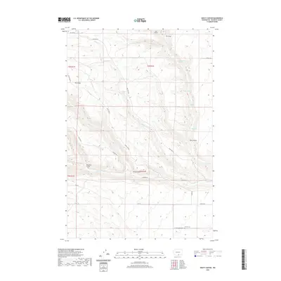
2020 Map of Douty Canyon
USGS Topo · Published 2020About this map
Sixprong Cem lies in the southern reaches of this Klickitat County landscape, served by Six Prong Cemetery Rd near the junction of Hale Rd and Jensen RD. This area is defined by a series of deep drainages and ridges, including the prominent Sand Ridge and the namesake Douty Canyon. The land is dotted with vital water sources such as Hagney Spring, Cottonwood Spring, and Rattlesnake Spring, which historically supported ranching and early settlement in this arid environment.
Find a feature on this map
30 named features on this map. Tap any name to fly to it.
Don’t see what you’re looking for? This feature index may not catch every label — zoom into the map to look around manually.
Map Details
Editions of this 2020 Douty Canyon Map
This is the sole edition of this map. No revisions or reprints were ever made.
Other maps of this area

1906 · Blalock Island
USGS Topo · 1:125,000

1908 · Blalock Island
USGS Topo · 1:125,000

1910 · Zillah
USGS Topo · 1:125,000

1915 · Prosser
USGS Topo · 1:125,000

1916 · Arlington
USGS Topo · 1:125,000

1917 · Prosser
USGS Topo · 1:125,000

1950 · Yakima
USGS Topo · 1:250,000

1953 · Pendleton
USGS Topo · 1:250,000

1953 · Walla Walla
USGS Topo · 1:250,000

1953 · The Dalles
USGS Topo · 1:250,000