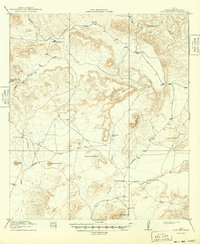
1918 Map of Dove Mountain
USGS Topo · Published 1949About this map
Isolated ranching outposts and high desert topography characterize this Brewster County landscape during the first World War. Surveyed in 1917, the terrain is defined by dramatic elevations such as Pine Mountain and the prominent Dove Mountain in the south. Settlement is sparse, represented by family-named landmarks like Gage Ranch and Jones Ranch, which were critical hubs for livestock and water management in an arid environment.
Find a feature on this map
21 named features on this map. Tap any name to fly to it.
Don’t see what you’re looking for? This feature index may not catch every label — zoom into the map to look around manually.
Map Details
Editions of this 1918 Dove Mountain Map
3 editions found
Other maps of this area

1917 · Bone Spring
USGS Topo · 1:62,500

1917 · Hood Spring
USGS Topo · 1:62,500

1918 · Reagan Canyon
USGS Topo · 1:62,500

1918 · Bone Spring
USGS Topo · 1:125,000

1918 · Hood Spring
USGS Topo · 1:62,500

1918 · Dove Mountain
USGS Topo · 1:62,500

1918 · Bone Spring
USGS Topo · 1:62,500

1918 · Bullis Gap
USGS Topo · 1:62,500

1919 · Maravillas Canyon
USGS Topo · 1:62,500

1920 · Longfellow
USGS Topo · 1:125,000