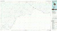
1985 Map of Dove Mountain
USGS Topo · Published 1985About this map
Black Gap Wildlife Management Area anchors the southwestern portion of this West Texas landscape, where the terrain is defined by the sharp descent of numerous drainages toward the Rio Grande. The map depicts a sparsely populated borderland during the mid-1980s, characterized by isolated peaks like Dove Mountain and Cupola Mountain. Settlement is minimal, represented by small points such as Loma Vista and Karen, and the area is crisscrossed by a network of jeep trails rather than developed roads. Water features are primarily intermittent, including Maravillas Creek and San Francisco Creek, which carve deep canyons like Reagan Canyon through the limestone of the Big Bend region. This study reveals the intricate drainage patterns of the Jackson Range and the Shatter Hills, providing a clear view of the topographical complexity along the Texas and Coahuila border before modern development altered the remote character of these ranchlands.
Find a feature on this map
59 named features on this map. Tap any name to fly to it.
Don’t see what you’re looking for? This feature index may not catch every label — zoom into the map to look around manually.
Map Details
Editions of this 1985 Dove Mountain Map
2 editions found
Other maps of this area

1903 · Chisos Mountains
USGS Topo · 1:125,000

1905 · Chisos Mountains
USGS Topo · 1:125,000

1917 · Bone Spring
USGS Topo · 1:62,500

1917 · Hood Spring
USGS Topo · 1:62,500

1918 · Reagan Canyon
USGS Topo · 1:62,500

1918 · Bone Spring
USGS Topo · 1:125,000

1918 · Hood Spring
USGS Topo · 1:62,500

1918 · Dryden Crossing
USGS Topo · 1:62,500

1918 · Dove Mountain
USGS Topo · 1:62,500

1918 · Bone Spring
USGS Topo · 1:62,500