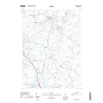
2021 Map of Dover East
USGS Topo · Published 2021About this map
The Salmon Falls River and Piscataqua River define the boundary between New Hampshire and Maine, threading through a landscape of historic industrial crossings and family homesteads. The Pan Am Railways corridor passes through Rollinsford Station and Crocketts Crossing, marking the long-standing rail connection between Somersworth and Dover. In the southern portion of the sheet, the tidal influence of the Bellamy River and Cocheco River meets at Dover Point, an area rich in genealogical interest with the Quaker Burying Ground and Dover Point Cem.
Find a feature on this map
241 named features on this map. Tap any name to fly to it.
Don’t see what you’re looking for? This feature index may not catch every label — zoom into the map to look around manually.
Map Details
Editions of this 2021 Dover East Map
This is the sole edition of this map. No revisions or reprints were ever made.
Other maps of this area

1891 · Berwick
USGS Topo · 1:62,500

1891 · Kennebunk
USGS Topo · 1:62,500

1893 · Kennebunk
USGS Topo · 1:62,500

1893 · Dover
USGS Topo · 1:62,500

1893 · Berwick
USGS Topo · 1:62,500

1893 · York
USGS Topo · 1:62,500

1898 · Kennebunk
USGS Topo · 1:62,500

1916 · Dover
USGS Topo · 1:62,500

1918 · Dover
USGS Topo · 1:62,500

1920 · York
USGS Topo · 1:62,500