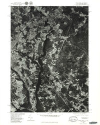
1977 Map of Dover East
USGS Topo · Published 1979About this map
The Salmon Falls River serves as the central artery and natural boundary on this orthophotograph, separating Strafford Co, New Hampshire, from York Co, Maine. Captured in the late 1970s, the imagery reveals the industrial and residential footprints of the interconnected communities of Somersworth, Rollinsford, and South Berwick. The confluence where the Cochecho River meets the larger drainage system underscores the historical importance of water power and river navigation to the development of Dover. This 1977 aerial perspective provides a clear view of the mid-century land use patterns, showing the proximity of dense town centers to the surrounding agricultural fields and forested tracts. Unlike traditional line maps, this photographic study allows for the direct observation of individual buildings, road alignments, and the specific texture of the New England landscape during a period of transition.
Find a feature on this map
8 named features on this map. Tap any name to fly to it.
Don’t see what you’re looking for? This feature index may not catch every label — zoom into the map to look around manually.
Map Details
Editions of this 1977 Dover East Map
This is the sole edition of this map. No revisions or reprints were ever made.
Other maps of this area

1891 · Berwick
USGS Topo · 1:62,500

1891 · Kennebunk
USGS Topo · 1:62,500

1893 · Kennebunk
USGS Topo · 1:62,500

1893 · Dover
USGS Topo · 1:62,500

1893 · Berwick
USGS Topo · 1:62,500

1893 · York
USGS Topo · 1:62,500

1898 · Kennebunk
USGS Topo · 1:62,500

1916 · Dover
USGS Topo · 1:62,500

1918 · Dover
USGS Topo · 1:62,500

1920 · York
USGS Topo · 1:62,500