
1932 Map of Dover-Foxcroft
USGS Topo · Published 1932About this map
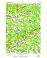
Piscataquis River flows eastward through the heart of this landscape, serving as a corridor for the Bangor and Aroostook RR and anchoring the dual settlement of Dover-Foxcroft. In the early 1930s, this region was a network of small mill hamlets and rural school districts. The economy is visible through industrial sites like Dover South Mills, Atkinson Mills, and Rollins Mill, while higher education is represented by the Higgins Classical Institute in Charleston. Numerous small schoolhouses, such as Bear Hill Sch and Hathaway Sch, dot the countryside at nearly every major road intersection, or "corner." The transition from valley floors to elevations like The Pinnacle and Davis Hill reveals a pattern of dispersed upland farming, connected by early routes like State Highway No 100. This survey documents a precise moment when rail sidings like Starbirds Siding still supported local timber and agricultural transport before the full modernization of the state highway system.
Find a feature on this map
96 named features on this map. Tap any name to fly to it.
Don’t see what you’re looking for? This feature index may not catch every label — zoom into the map to look around manually.
Map Details
Editions of this 1932 Dover-Foxcroft Map
4 editions found
Other maps of this area

1902 · Bangor
USGS Topo · 1:62,500

1930 · Pittsfield
USGS Topo · 1:48,000

1931 · Stetson
USGS Topo · 1:48,000

1932 · Pittsfield
USGS Topo · 1:62,500

1933 · Boyd Lake
USGS Topo · 1:62,500

1933 · Pittsfield
USGS Topo · 1:62,500

1933 · Guilford
USGS Topo · 1:62,500

1935 · Dover-Foxcroft
USGS Topo · 1:62,500

1935 · Stetson
USGS Topo · 1:62,500

1937 · Guilford
USGS Topo · 1:62,500