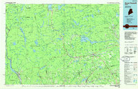
1986 Map of Dover-Foxcroft
USGS Topo · Published 1986About this map
The Piscataquis River corridor anchors this mid-1980s portrait of north-central Maine, where timber, water, and rail shaped the regional economy. The shire town of Dover-Foxcroft serves as a central hub, surrounded by smaller industrial outposts like Dover South Mills and Abbot Village. Transportation networks are clearly defined, featuring the intersection of the Canadian Pacific and Bangor and Aroostook railroads, which facilitated the movement of resources from the vast woodlands to the south.
Find a feature on this map
81 named features on this map. Tap any name to fly to it.
Don’t see what you’re looking for? This feature index may not catch every label — zoom into the map to look around manually.
Map Details
Editions of this 1986 Dover-Foxcroft Map
This is the sole edition of this map. No revisions or reprints were ever made.
Other maps of this area

1902 · Bangor
USGS Topo · 1:62,500

1903 · Bingham
USGS Topo · 1:62,500

1904 · Anson
USGS Topo · 1:62,500

1905 · Bingham
USGS Topo · 1:62,500

1905 · The Forks
USGS Topo · 1:62,500

1907 · The Forks
USGS Topo · 1:62,500

1913 · Skowhegan
USGS Topo · 1:62,500

1920 · Moosehead Lake
USGS Topo · 1:62,500

1921 · Brassua Lake
USGS Topo · 1:62,500

1922 · Moosehead Lake
USGS Topo · 1:62,500