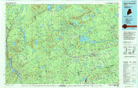
1994 Map of Dover-Foxcroft
USGS Topo · Published 1994About this map
Piscataquis River and the Kennebec River define the hydraulic character of this central Maine region, where the industrial heritage of textile and lumber mills is visible in towns like Dover-Foxcroft and Guilford. The landscape transitions from the higher elevations of Boarstone Mountain and Benson Mountain in the north toward the rolling farm and woodland of the southern reaches. This late-twentieth-century compilation highlights a significant transition in land use, showing the Moscow Air Force Station Transmit Site alongside established recreational corridors like Peaks-Kenny State Park. Transportation networks are dominated by the Canadian Pacific RR and Bangor & Aroostook RR, which historically connected these woods to the broader Atlantic markets. The presence of numerous smaller settlements like Shirley Mills and Abbot Village illustrates a settlement pattern deeply tied to local water power and the timber industry.
Find a feature on this map
78 named features on this map. Tap any name to fly to it.
Don’t see what you’re looking for? This feature index may not catch every label — zoom into the map to look around manually.
Map Details
Editions of this 1994 Dover-Foxcroft Map
This is the sole edition of this map. No revisions or reprints were ever made.
Other maps of this area

1902 · Bangor
USGS Topo · 1:62,500

1903 · Bingham
USGS Topo · 1:62,500

1904 · Anson
USGS Topo · 1:62,500

1905 · Bingham
USGS Topo · 1:62,500

1905 · The Forks
USGS Topo · 1:62,500

1907 · The Forks
USGS Topo · 1:62,500

1913 · Skowhegan
USGS Topo · 1:62,500

1920 · Moosehead Lake
USGS Topo · 1:62,500

1921 · Brassua Lake
USGS Topo · 1:62,500

1922 · Moosehead Lake
USGS Topo · 1:62,500