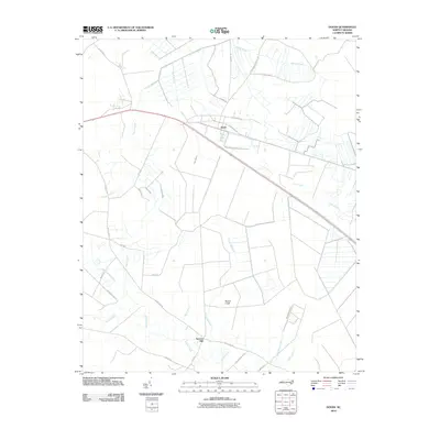
2010 Map of Dover
USGS Topo · Published 2010About this map
The town of Dover anchors this coastal plain landscape, where a sophisticated network of drainage and transport routes intersects with an intricate swamp system. The topography is defined by the slow-moving waters of Tracey Swamp, Gum Swamp, and Flat Swamp, which weave through the agricultural and forested tracts. To the south, Sassers Mill sits at the crossing of Beaver Creek and Heath Mill Run, representing a localized point of historical industry and transit. This survey illustrates the modern configuration of rural infrastructure, including Old Us 70 and the various farm-to-market roads like Wyse Fork Rd and Tilghman Rd. The presence of features such as Rattlesnake Branch and Deep Bottom Branch highlights the hydrology of the Neuse River basin, showcasing how the environment has been navigated and managed for farming and settlement into the 21st century.
Find a feature on this map
33 named features on this map. Tap any name to fly to it.
Don’t see what you’re looking for? This feature index may not catch every label — zoom into the map to look around manually.
Map Details
Editions of this 2010 Dover Map
This is the sole edition of this map. No revisions or reprints were ever made.
Other maps of this area

1902 · Ayden
USGS Topo · 1:62,500

1903 · Trent River
USGS Topo · 1:62,500

1904 · Ayden
USGS Topo · 1:62,500

1904 · Trent River
USGS Topo · 1:62,500

1914 · Kinston
USGS Topo · 1:48,000

1916 · Kinston
USGS Topo · 1:62,500

1953 · Rocky Mount
USGS Topo · 1:250,000

1954 · Rocky Mount
USGS Topo · 1:250,000

1958 · Deep Run
USGS Topo · 1:62,500
1980 · Rivermont
USGS Topo · 1:24,000