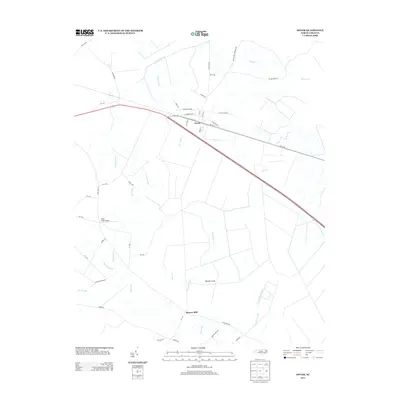
2013 Map of Dover
USGS Topo · Published 2013About this map
Dover serves as the central hub of this eastern North Carolina landscape, where the local street grid is defined by its proximity to Railroad St and the thoroughfare of Route 70. The surrounding terrain is a mosaic of agriculture and wetlands, heavily influenced by drainage systems including Tracey Swamp and Gum Swamp. To the south, Sassers Mill sits along the winding path of Beaver Creek, indicating a legacy of local water-driven industry in the coastal plain.
Find a feature on this map
52 named features on this map. Tap any name to fly to it.
Don’t see what you’re looking for? This feature index may not catch every label — zoom into the map to look around manually.
Map Details
Editions of this 2013 Dover Map
This is the sole edition of this map. No revisions or reprints were ever made.
Other maps of this area

1902 · Ayden
USGS Topo · 1:62,500

1903 · Trent River
USGS Topo · 1:62,500

1904 · Ayden
USGS Topo · 1:62,500

1904 · Trent River
USGS Topo · 1:62,500

1914 · Kinston
USGS Topo · 1:48,000

1916 · Kinston
USGS Topo · 1:62,500

1953 · Rocky Mount
USGS Topo · 1:250,000

1954 · Rocky Mount
USGS Topo · 1:250,000

1958 · Deep Run
USGS Topo · 1:62,500
1980 · Rivermont
USGS Topo · 1:24,000