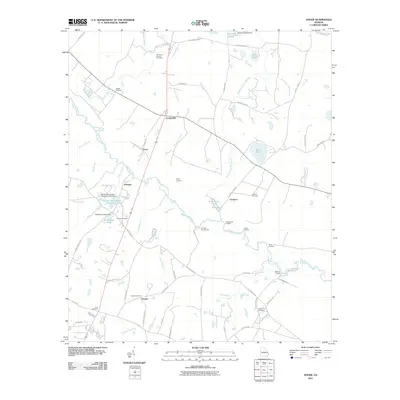
2011 Map of Dover
USGS Topo · Published 2011About this map
The Ogeechee River meanders across this landscape, defining a network of landings and creek junctions that have shaped local settlement for generations. Small communities and rail-side hamlets such as Dover, Cooperville, and Donegal are distributed along the primary transportation corridors, while the riverbanks feature several historic access points including Evans Landing, Dows Landing, and Hendersons Landing. The map reveals a high concentration of family and community burial grounds, providing a significant resource for genealogical research into the area's rural history.
Find a feature on this map
77 named features on this map. Tap any name to fly to it.
Don’t see what you’re looking for? This feature index may not catch every label — zoom into the map to look around manually.
Map Details
Editions of this 2011 Dover Map
This is the sole edition of this map. No revisions or reprints were ever made.
Other maps of this area

1918 · Oliver
USGS Topo · 1:62,500

1920 · Statesboro
USGS Topo · 1:62,500

1920 · Oliver
USGS Topo · 1:62,500

1921 · Brooklet
USGS Topo · 1:62,500

1921 · Rocky Ford
USGS Topo · 1:62,500

1943 · Brooklet
USGS Topo · 1:62,500

1943 · Rocky Ford
USGS Topo · 1:62,500

1943 · Millen
USGS Topo · 1:125,000

1943 · Statesboro
USGS Topo · 1:62,500

1943 · Oliver
USGS Topo · 1:62,500