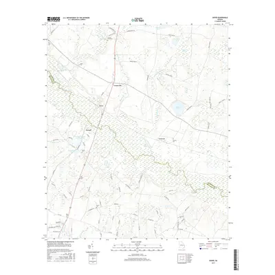
2017 Map of Dover
USGS Topo · Published 2017About this map
The Ogeechee River carves a winding path through the borderlands of Screven and Bulloch Counties, defining the drainage of this coastal plain landscape. Small agricultural settlements and community hubs such as Cooperville, Dover, and Donegal are linked by a network of rural roads and the rail corridor that cuts diagonally across the terrain. The geography is characterized by numerous bays and ponds, including Jarrell Pond, Mobley Bay, and Morgan Bay, which dot the woodlands away from the main river channel.
Find a feature on this map
88 named features on this map. Tap any name to fly to it.
Don’t see what you’re looking for? This feature index may not catch every label — zoom into the map to look around manually.
Map Details
Editions of this 2017 Dover Map
This is the sole edition of this map. No revisions or reprints were ever made.
Other maps of this area

1918 · Oliver
USGS Topo · 1:62,500

1920 · Statesboro
USGS Topo · 1:62,500

1920 · Oliver
USGS Topo · 1:62,500

1921 · Brooklet
USGS Topo · 1:62,500

1921 · Rocky Ford
USGS Topo · 1:62,500

1943 · Brooklet
USGS Topo · 1:62,500

1943 · Rocky Ford
USGS Topo · 1:62,500

1943 · Millen
USGS Topo · 1:125,000

1943 · Statesboro
USGS Topo · 1:62,500

1943 · Oliver
USGS Topo · 1:62,500