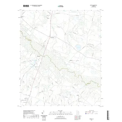
2020 Map of Dover
USGS Topo · Published 2020About this map
The Ogeechee River meanders across this landscape, forming the boundary between Screven Co and Bulloch Co in southeast Georgia. This region is defined by its extensive wetland systems and named bays, including Horse Pen Bay, Mobley Bay, and Morgan Bay. Small rural settlements like Dover, Cooperville, Donegal, and Cameron are scattered throughout the quadrangle, connected by a network of local roads such as Old River Rd and Five Chop Rd.
Find a feature on this map
83 named features on this map. Tap any name to fly to it.
Don’t see what you’re looking for? This feature index may not catch every label — zoom into the map to look around manually.
Map Details
Editions of this 2020 Dover Map
This is the sole edition of this map. No revisions or reprints were ever made.
Other maps of this area

1918 · Oliver
USGS Topo · 1:62,500

1920 · Statesboro
USGS Topo · 1:62,500

1920 · Oliver
USGS Topo · 1:62,500

1921 · Brooklet
USGS Topo · 1:62,500

1921 · Rocky Ford
USGS Topo · 1:62,500

1943 · Brooklet
USGS Topo · 1:62,500

1943 · Rocky Ford
USGS Topo · 1:62,500

1943 · Millen
USGS Topo · 1:125,000

1943 · Statesboro
USGS Topo · 1:62,500

1943 · Oliver
USGS Topo · 1:62,500