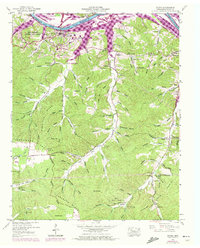
1950 Map of Dover
USGS Topo · Published 1972About this map
Fort Donelson National Battlefield and the town of Dover overlook the bends of the Cumberland River, where the creation of Barkley Lake has fundamentally altered the shoreline and lower valley drainage. This survey, updated with 1971 aerial data, shows the river as a managed waterway supporting the Barkley Waterfowl Management Area and Cross Creeks National Wildlife Refuge. The landscape is defined by the high ground of the Tennessee Ridge and its many named hollows, including Potatopatch Hollow and Gum Spring Hollow. Local genealogy is well-represented through numerous family burial sites such as Settle Cem, Byrd Cem, and Brigham Cem, alongside rural landmarks like Corinth Ch and the Lower Long Creek School. The presence of the Battlefield Memorial Highway and the National Cem underscores the area's deep ties to Civil War history within the broader Stewart State Forest.
Find a feature on this map
110 named features on this map. Tap any name to fly to it.
Don’t see what you’re looking for? This feature index may not catch every label — zoom into the map to look around manually.
Map Details
Editions of this 1950 Dover Map
4 editions found
Other maps of this area

1931 · Erin
USGS Topo · 1:62,500

1936 · Tharpe
USGS Topo · 1:24,000

1936 · Tantrough Hollow
USGS Topo · 1:24,000

1936 · McKinnon
USGS Topo · 1:24,000

1936 · Stewart
USGS Topo · 1:24,000

1936 · Standing Rock
USGS Topo · 1:24,000

1936 · Dover
USGS Topo · 1:24,000

1950 · Stewart
USGS Topo · 1:24,000

1950 · Standing Rock
USGS Topo · 1:24,000

1950 · Dover
USGS Topo · 1:24,000