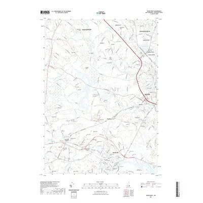
2021 Map of Dover West
USGS Topo · Published 2021About this map
The University of New Hampshire campus dominates the southern landscape of this 2021 survey, situated at the heart of Durham. The surrounding area reflects a dense historical record preserved in its many family burial grounds, including the Albert Snell Cem, Demerritt Cem, and the Twombly Cem. The terrain is defined by the winding paths of the Cocheco River and Bellamy River, which feed into local landmarks like the Bellamy River Reservoir and Durham Reservoir.
Find a feature on this map
232 named features on this map. Tap any name to fly to it.
Don’t see what you’re looking for? This feature index may not catch every label — zoom into the map to look around manually.
Map Details
Editions of this 2021 Dover West Map
This is the sole edition of this map. No revisions or reprints were ever made.
Other maps of this area

1891 · Berwick
USGS Topo · 1:62,500

1893 · Dover
USGS Topo · 1:62,500

1893 · Berwick
USGS Topo · 1:62,500

1916 · Dover
USGS Topo · 1:62,500

1917 · Mt. Pawtuckaway
USGS Topo · 1:62,500

1918 · Dover
USGS Topo · 1:62,500

1919 · Mt. Pawtuckaway
USGS Topo · 1:62,500

1919 · Alton
USGS Topo · 1:62,500

1933 · Berwick
USGS Topo · 1:48,000

1937 · Berwick
USGS Topo · 1:62,500