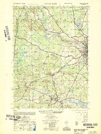
1952 Map of Dover West
USGS Topo · Published 1952About this map
The University of New Hampshire anchors the southern portion of this mid-century survey, a landscape defined by the winding paths of the Cocheco River and the Bellamy River. While the growing campus and the village of Durham show early post-war expansion, the surrounding townships of Madbury and Barrington remain largely rural, characterized by family-named landmarks like Hayes Hill and Stevens Hill. This geography is shaped by water and iron; the Boston and Maine RR and Maine Central RR bisect the terrain, connecting industrial centers to the smaller outposts like East Barrington and the Strafford County Farm. Local social hubs are clearly marked, from the Grange Hall near Blackwater Hill to the Madbury Church and several rural schoolhouses. The presence of Granite State Park and Willand Pond in the northeast suggests a transition toward more formal recreational spaces as the nearby city of Dover begins to exert its influence on the countryside.
Find a feature on this map
74 named features on this map. Tap any name to fly to it.
Don’t see what you’re looking for? This feature index may not catch every label — zoom into the map to look around manually.
Map Details
Editions of this 1952 Dover West Map
This is the sole edition of this map. No revisions or reprints were ever made.
Other maps of this area

1891 · Berwick
USGS Topo · 1:62,500

1893 · Dover
USGS Topo · 1:62,500

1893 · Berwick
USGS Topo · 1:62,500

1916 · Dover
USGS Topo · 1:62,500

1917 · Mt. Pawtuckaway
USGS Topo · 1:62,500

1918 · Dover
USGS Topo · 1:62,500

1919 · Mt. Pawtuckaway
USGS Topo · 1:62,500

1919 · Alton
USGS Topo · 1:62,500

1933 · Berwick
USGS Topo · 1:48,000

1937 · Berwick
USGS Topo · 1:62,500