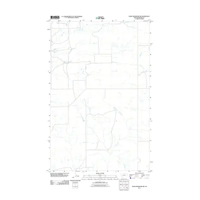
2011 Map of Down Reservoir SW
USGS Topo · Published 2011About this map
Milk Creek winds through this northern Montana landscape, marking a drainage system that defines the local geography south of the Milk River valley. The terrain is etched by seasonal watercourses and coulees, including the branching reaches of Black Creek and Dodson Creek further east. This 2011 survey by the U.S. Geological Survey illustrates a sparsely populated section of the high plains where ranch roads provide the primary infrastructure. The inclusion of Swartz Rd indicates the vital, though infrequent, transportation arteries that connect these remote grazing lands. The map detail highlights the subtle depressions and ephemeral ponds common to this prairie environment, showing a landscape managed for wide-scale agricultural use and ranching.
Find a feature on this map
4 named features on this map. Tap any name to fly to it.
Don’t see what you’re looking for? This feature index may not catch every label — zoom into the map to look around manually.
Map Details
Editions of this 2011 Down Reservoir SW Map
This is the sole edition of this map. No revisions or reprints were ever made.
Other maps of this area

1903 · Wayne Creek
USGS Topo · 1:62,500

1905 · Wayne Creek
USGS Topo · 1:62,500

1913 · Cherry Ridge
USGS Topo · 1:125,000

1920 · Avery
USGS Topo · 1:125,000

1953 · Havre
USGS Topo · 1:250,000

1957 · Havre
USGS Topo · 1:250,000

1958 · Havre
USGS Topo · 1:250,000

1964 · Wayne Creek SE
USGS Topo · 1:24,000

1964 · Coburg
USGS Topo · 1:24,000
1964 · Savoy
USGS Topo · 1:24,000