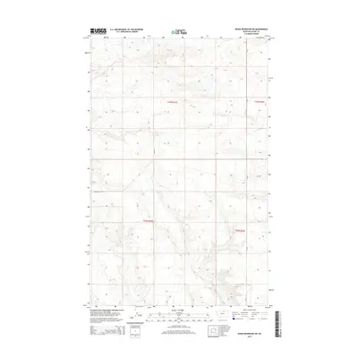
2014 Map of Down Reservoir SW
USGS Topo · Published 2014About this map
High plains drainage systems define this section of Blaine County, where the topography is carved by ephemeral watercourses such as Black Cr in the north and Milk Cr to the south. The landscape is primarily organized by the Public Land Survey System, with township and range lines like t33n r25e and t32n r26e providing the structural grid for land ownership. Small-scale human imprints are visible through a sparse network of rural routes, including the descriptively named Homestead Trl and Baker Ln. These roads, along with Cr-25, represent the essential infrastructure for ranching and agricultural operations in this corner of Montana, where the terrain gently rolls between intermittent stream beds and higher ground near Dodson Cr.
Find a feature on this map
10 named features on this map. Tap any name to fly to it.
Don’t see what you’re looking for? This feature index may not catch every label — zoom into the map to look around manually.
Map Details
Editions of this 2014 Down Reservoir SW Map
This is the sole edition of this map. No revisions or reprints were ever made.
Other maps of this area

1903 · Wayne Creek
USGS Topo · 1:62,500

1905 · Wayne Creek
USGS Topo · 1:62,500

1913 · Cherry Ridge
USGS Topo · 1:125,000

1920 · Avery
USGS Topo · 1:125,000

1953 · Havre
USGS Topo · 1:250,000

1957 · Havre
USGS Topo · 1:250,000

1958 · Havre
USGS Topo · 1:250,000

1964 · Wayne Creek SE
USGS Topo · 1:24,000

1964 · Coburg
USGS Topo · 1:24,000
1964 · Savoy
USGS Topo · 1:24,000