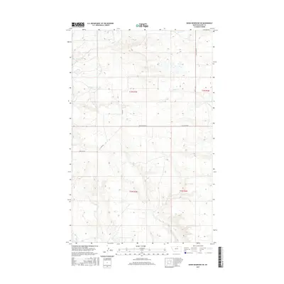
2017 Map of Down Reservoir SW
USGS Topo · Published 2017About this map
The low-lying drainage basins of Blaine County are meticulously detailed in this recent topographic survey, focused on the meandering paths of Milk Cr and Black Cr. The landscape is defined by the Public Land Survey System, with township and range lines like t33n r25e and t32n r26e providing the primary spatial framework for the region. These boundaries organize a terrain where water management and intermittent streams like Dodson Cr are the most prominent natural landmarks.
Find a feature on this map
11 named features on this map. Tap any name to fly to it.
Don’t see what you’re looking for? This feature index may not catch every label — zoom into the map to look around manually.
Map Details
Editions of this 2017 Down Reservoir SW Map
This is the sole edition of this map. No revisions or reprints were ever made.
Other maps of this area

1903 · Wayne Creek
USGS Topo · 1:62,500

1905 · Wayne Creek
USGS Topo · 1:62,500

1913 · Cherry Ridge
USGS Topo · 1:125,000

1920 · Avery
USGS Topo · 1:125,000

1953 · Havre
USGS Topo · 1:250,000

1957 · Havre
USGS Topo · 1:250,000

1958 · Havre
USGS Topo · 1:250,000

1964 · Wayne Creek SE
USGS Topo · 1:24,000

1964 · Coburg
USGS Topo · 1:24,000
1964 · Savoy
USGS Topo · 1:24,000