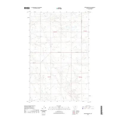
2020 Map of Down Reservoir SW
USGS Topo · Published 2020About this map
Milk Cr and Eureka Cr flow through this section of Blaine County, carving paths through a landscape defined by seasonal drainages and prairie plateaus. The drainage patterns of Black Cr and Dodson Cr indicate a complex hydrology that has shaped local land use for generations. Small-scale access routes like Homestead Trl and Baker Rd reveal the persistent grid of the Public Land Survey System, which remains the primary framework for navigation and property boundaries in this part of Montana. The intersection of these local roads with topographical features such as Black Coulee Rd illustrates the historical adaptation of travel paths to the natural contours of the northern plains, where coulees and creek beds dictate the movement of both water and commerce.
Find a feature on this map
12 named features on this map. Tap any name to fly to it.
Don’t see what you’re looking for? This feature index may not catch every label — zoom into the map to look around manually.
Map Details
Editions of this 2020 Down Reservoir SW Map
This is the sole edition of this map. No revisions or reprints were ever made.
Other maps of this area

1903 · Wayne Creek
USGS Topo · 1:62,500

1905 · Wayne Creek
USGS Topo · 1:62,500

1913 · Cherry Ridge
USGS Topo · 1:125,000

1920 · Avery
USGS Topo · 1:125,000

1953 · Havre
USGS Topo · 1:250,000

1957 · Havre
USGS Topo · 1:250,000

1958 · Havre
USGS Topo · 1:250,000

1964 · Wayne Creek SE
USGS Topo · 1:24,000

1964 · Coburg
USGS Topo · 1:24,000
1964 · Savoy
USGS Topo · 1:24,000