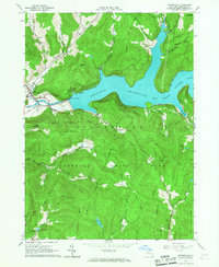
1965 Map of Downsville
USGS Topo · Published 1967About this map
Pepacton Reservoir dominates this 1965 survey, its waters contained by the massive dam structure near Downsville. This engineering project fundamentally altered the valley of the East Branch Delaware River, creating a large reservoir for the New York City Water Supply. The village of Downsville remains the primary hub, featuring the Central Sch, a Covered Bridge, and the Paige Cem.
Find a feature on this map
51 named features on this map. Tap any name to fly to it.
Don’t see what you’re looking for? This feature index may not catch every label — zoom into the map to look around manually.
Map Details
Editions of this 1965 Downsville Map
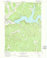
2 editions found
Other maps of this area

1920 · Long Eddy
USGS Topo · 1:62,500

1921 · Long Eddy
USGS Topo · 1:48,000

1921 · Livingston Manor
USGS Topo · 1:62,500

1922 · Andes
USGS Topo · 1:62,500

1923 · Long Eddy
USGS Topo · 1:62,500

1923 · Walton
USGS Topo · 1:48,000

1923 · Livingston Manor
USGS Topo · 1:62,500

1924 · Andes
USGS Topo · 1:62,500

1925 · Walton
USGS Topo · 1:62,500

1943 · Honesdale
USGS Topo · 1:125,000