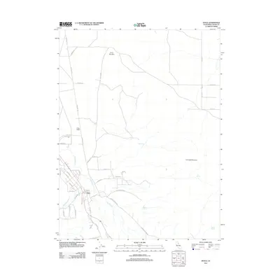
2012 Map of Doyle
USGS Topo · Published 2012About this map
The high desert community of Doyle sits at the base of the Fort Sage Mountains in Lassen County, where the transition between valley and mountain is defined by complex drainage networks. This 2012 topographic study illustrates how seasonal water sources like Indian Spring, Jesus Spring, and Steffens Spring have historically dictated movement and ranching patterns in this arid region. The drainage of Long Valley Cr and Willow Ranch Cr flows toward the extensive Long Valley flats, while local infrastructure like the Doyle Grade and Doyle Loop connects the small settlement to the surrounding landscape. Elevations are dominated by the volcanic mass of Turtle Mountain to the north and the rising peaks of the Fort Sage Mountains to the east, with a network of local routes such as Hackstaff Rd and Constantia Rd providing access to remote homesteads and ranching allotments.
Find a feature on this map
39 named features on this map. Tap any name to fly to it.
Don’t see what you’re looking for? This feature index may not catch every label — zoom into the map to look around manually.
Map Details
Editions of this 2012 Doyle Map
This is the sole edition of this map. No revisions or reprints were ever made.
Other maps of this area

1886 · Honey Lake
USGS Topo · 1:250,000

1886 · Granite Range
USGS Topo · 1:250,000

1890 · Sierraville
USGS Topo · 1:125,000

1891 · Honey Lake
USGS Topo · 1:250,000

1891 · Reno
USGS Topo · 1:125,000

1892 · Sierraville
USGS Topo · 1:125,000

1893 · Honey Lake
USGS Topo · 1:250,000

1893 · Reno
USGS Topo · 1:125,000

1894 · Granite Range
USGS Topo · 1:250,000

1894 · Sierraville
USGS Topo · 1:125,000