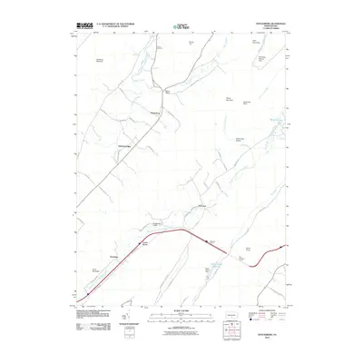
2010 Map of Doylesburg
USGS Topo · Published 2010About this map
Doylesburg and Doylestown anchor this rural landscape in Franklin County, situated where the valley floor meets the slopes of Tuscarora Mountain. The area is characterized by a mix of narrow valley farming and heavily forested ridges, with the West Branch Conococheague Creek and Trout Run providing the primary drainage. A significant engineering feature of the corridor is the passage of the Pennsylvania Turnpike, which utilizes the Kittatinny Tunnel and Blue Mountain Tunnel to navigate the surrounding terrain. Local history and genealogy are well-represented through markers like United Cemetery and small communities such as Amberson Valley, Laurel Grove, and Newbridge. In the northeast corner, the Hemlocks Natural Area preserves a pocket of older growth near Patterson Run.
Find a feature on this map
51 named features on this map. Tap any name to fly to it.
Don’t see what you’re looking for? This feature index may not catch every label — zoom into the map to look around manually.
Map Details
Editions of this 2010 Doylesburg Map
This is the sole edition of this map. No revisions or reprints were ever made.
Other maps of this area

1919 · Mattawana
USGS Topo · 1:62,500

1922 · Mt Union
USGS Topo · 1:48,000

1923 · Shippensburg
USGS Topo · 1:62,500

1924 · Mt. Union
USGS Topo · 1:62,500

1936 · East Waterford
USGS Topo · 1:48,000

1939 · Orbisonia
USGS Topo · 1:62,500

1940 · Orbisonia
USGS Topo · 1:62,500

1941 · East Waterford
USGS Topo · 1:62,500

1943 · Shippensburg
USGS Topo · 1:62,500

1944 · Orbisonia
USGS Topo · 1:62,500
Featured Places
- Lurgan Township, PA
- Amberson Valley Estates, Fannett Township
- Laurel Grove, Fannett Township
- Newbridge, Fannett Township
- Tell Township, PA