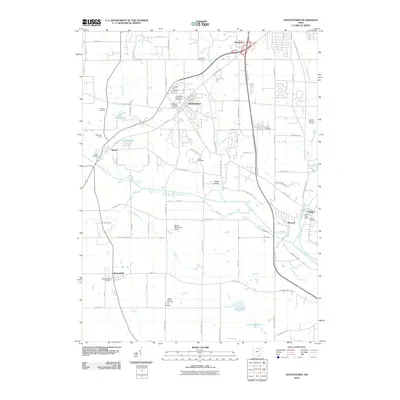
2010 Map of Doylestown
USGS Topo · Published 2010About this map
Doylestown sits atop the high ground of this northeastern Ohio landscape, serving as a hub for local routes like Church St and Portage St. The surrounding terrain is defined by the winding course of Chippewa Creek and its many tributaries, including Silver Creek and Mill Creek. To the southeast, the village of Warwick and the neighboring Clinton are situated along the Tuscarawas River, where the Clinton Post Office and Clinton Cemetery mark the center of local community life.
Find a feature on this map
87 named features on this map. Tap any name to fly to it.
Don’t see what you’re looking for? This feature index may not catch every label — zoom into the map to look around manually.
Map Details
Editions of this 2010 Doylestown Map
This is the sole edition of this map. No revisions or reprints were ever made.
Other maps of this area

1901 · Massillon
USGS Topo · 1:62,500

1901 · Wooster
USGS Topo · 1:62,500

1903 · Massillon
USGS Topo · 1:62,500

1903 · Wooster
USGS Topo · 1:62,500

1903 · Akron
USGS Topo · 1:62,500

1904 · Medina
USGS Topo · 1:62,500

1905 · Akron
USGS Topo · 1:62,500

1906 · Medina
USGS Topo · 1:62,500

1950 · Cleveland
USGS Topo · 1:250,000

1951 · Canton
USGS Topo · 1:250,000