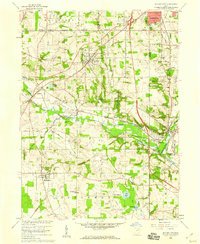
1958 Map of Doylestown
USGS Topo · Published 1959About this map
Chippewa Creek winds through a landscape defined by an extensive transportation corridor where the Pennsylvania Railroad, Erie Railroad, and Baltimore and Ohio Railroad converge. This 1958 survey shows the industrial and rural character of the region, anchored by the hilltop village of Doylestown and the rail-oriented settlements of Warwick and Clinton along the Tuscarawas River. The presence of numerous family-named landmarks like Harvey Cem and Grill Sch provides a precise record of late-1950s property and community distribution.
Find a feature on this map
60 named features on this map. Tap any name to fly to it.
Don’t see what you’re looking for? This feature index may not catch every label — zoom into the map to look around manually.
Map Details
Editions of this 1958 Doylestown Map
This is the sole edition of this map. No revisions or reprints were ever made.
Other maps of this area

1901 · Massillon
USGS Topo · 1:62,500

1901 · Wooster
USGS Topo · 1:62,500

1903 · Massillon
USGS Topo · 1:62,500

1903 · Wooster
USGS Topo · 1:62,500

1903 · Akron
USGS Topo · 1:62,500

1904 · Medina
USGS Topo · 1:62,500

1905 · Akron
USGS Topo · 1:62,500

1906 · Medina
USGS Topo · 1:62,500

1950 · Cleveland
USGS Topo · 1:250,000

1951 · Canton
USGS Topo · 1:250,000