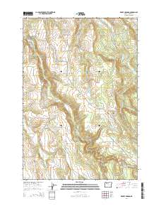
2014 Map of Drake Crossing
USGS Topo · Published 2014About this map
Silverton Hills and the small settlement of Drake Crossing characterize this portion of Marion County, where the landscape is defined by the complex drainage systems of Silver Creek, Abiqua Creek, and Drift Creek. The presence of several family or community burial grounds, such as Lewis Cemetery and Mountain View Cemetery, indicates a well-established rural population. The area is notable for its water resources and elevation changes, featuring multiple reservoirs like Keohler Reservoir and Pichette Reservoir, alongside natural landmarks such as Drift Creek Falls and Winter Falls. A dense network of local roads, including Silver Falls Drive NE and Abiqua Road NE, links the scattered residences and points of interest across the township boundaries. This survey documents the intersection of agricultural land and managed water systems prior to further residential expansion in the region.
Find a feature on this map
63 named features on this map. Tap any name to fly to it.
Don’t see what you’re looking for? This feature index may not catch every label — zoom into the map to look around manually.
Map Details
Editions of this 2014 Drake Crossing Map
This is the sole edition of this map. No revisions or reprints were ever made.
Other maps of this area

1923 · Mount Angel
USGS Topo · 1:62,500

1925 · Stayton
USGS Topo · 1:62,500

1939 · Molalla
USGS Topo · 1:62,500

1940 · Molalla
USGS Topo · 1:62,500

1940 · Mount Angel
USGS Topo · 1:62,500

1941 · Stayton
USGS Topo · 1:62,500

1948 · Vancouver
USGS Topo · 1:250,000

1950 · Vancouver
USGS Topo · 1:250,000

1950 · Vancouver
USGS Topo · 1:250,000

1951 · Lyons
USGS Topo · 1:62,500