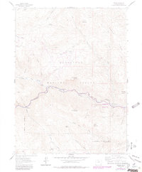
1962 Map of Drake
USGS Topo · Published 1984About this map
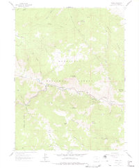
The Big Thompson River carves a path through the heart of the Roosevelt National Forest on this 1960s-era topographical study, which includes aerial revisions from the late 1970s. The settlement at Drake serves as a focal point where the North Fork Big Thompson River meets the main channel, anchoring a corridor of small riverfront communities including Midway, Waltonia, and Cedar Cove. This mountain landscape is defined by its deep canyons and steep gulches, such as Sullivan Gulch and Galuchie Gulch, which isolate high-elevation flats like Cedar Park and Galuchie Park.
Find a feature on this map
47 named features on this map. Tap any name to fly to it.
Don’t see what you’re looking for? This feature index may not catch every label — zoom into the map to look around manually.
Map Details
Editions of this 1962 Drake Map
6 editions found
Other maps of this area

1905 · Mount Olympus
USGS Topo · 1:62,500

1906 · Loveland
USGS Topo · 1:62,500

1906 · Fort Collins
USGS Topo · 1:62,500

1907 · Mount Olympus
USGS Topo · 1:62,500

1907 · Livermore
USGS Topo · 1:125,000

1908 · Loveland
USGS Topo · 1:62,500

1908 · Fort Collins
USGS Topo · 1:62,500

1909 · Livermore
USGS Topo · 1:125,000

1954 · Greeley
USGS Topo · 1:250,000

1957 · Greeley
USGS Topo · 1:250,000