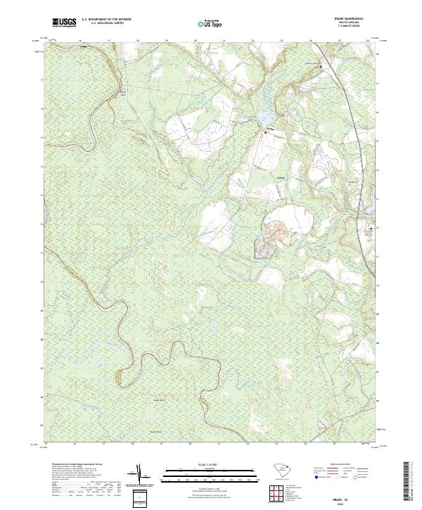
2024 Map of Drake
USGS Topo · Published 2024About this map
The Great Pee Dee River meanders across the border of Marlboro Co and Darlington Co, defining a landscape of wetlands and riverine bends. This modern survey details the intricate hydrology of the Pee Dee basin, where features like Culps Neck and Byrds Island sit within the river's wide floodplain. Small rural settlements like Drake and Genoa are situated on higher ground away from the marshes, connected by a network of local roads such as Oak River Rd and Co Rd 18.
Find a feature on this map
49 named features on this map. Tap any name to fly to it.
Don’t see what you’re looking for? This feature index may not catch every label — zoom into the map to look around manually.
Map Details
Editions of this 2024 Drake Map
This is the sole edition of this map. No revisions or reprints were ever made.
Other maps of this area

1942 · Rockingham
USGS Topo · 1:125,000

1943 · Gum Swamp
USGS Topo · 1:62,500

1953 · Florence
USGS Topo · 1:250,000

1954 · Florence
USGS Topo · 1:250,000

1963 · Mont Clare
USGS Topo · 1:24,000

1963 · Darlington East
USGS Topo · 1:24,000

1971 · Society Hill
USGS Topo · 1:24,000

1972 · Drake
USGS Topo · 1:24,000

1972 · Clio
USGS Topo · 1:24,000
1972 · Oak Grove
USGS Topo · 1:24,000