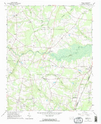
1963 Map of Drake
USGS Topo · Published 1964About this map
North Carolina Wesleyan College sits at the southern edge of this Nash County landscape, marking a period of significant institutional growth just north of the Edgecombe County line. The terrain is defined by the winding course of Swift Creek and its many tributaries, including Black Swamp and Beaverdam Swamp, which dictate the placement of small rural communities. The Atlantic Coast Line railroad runs through the eastern corridor, serving the established settlement of Battleboro.
Find a feature on this map
46 named features on this map. Tap any name to fly to it.
Don’t see what you’re looking for? This feature index may not catch every label — zoom into the map to look around manually.
Map Details
Editions of this 1963 Drake Map
2 editions found

Other maps of this area

1902 · Rocky Mount
USGS Topo · 1:62,500

1902 · Tarboro
USGS Topo · 1:62,500

1903 · Tarboro
USGS Topo · 1:62,500

1904 · Rocky Mount
USGS Topo · 1:62,500

1953 · Norfolk
USGS Topo · 1:250,000

1953 · Rocky Mount
USGS Topo · 1:250,000

1954 · Rocky Mount
USGS Topo · 1:250,000

1961 · Whitakers
USGS Topo · 1:24,000

1961 · Enfield
USGS Topo · 1:24,000

1963 · Ringwood
USGS Topo · 1:24,000