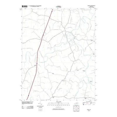
2010 Map of Drake
USGS Topo · Published 2010About this map
Drakes Creek and its major tributaries, the Middle Fork Drakes Creek and West Fork Drakes Creek, define the topography of this rural Kentucky landscape near the Tennessee border. The map documents a network of small, established communities including Drake, Gold City, and Temperance, linked by winding county roads like Old Drake Temperance Rd and Matlock Pike. These settlements represent the traditional agrarian heart of the region, where family names are etched into the geography via landmarks like Hopewell Cemetery and Coldwater Cemetery.
Find a feature on this map
68 named features on this map. Tap any name to fly to it.
Don’t see what you’re looking for? This feature index may not catch every label — zoom into the map to look around manually.
Map Details
Editions of this 2010 Drake Map
This is the sole edition of this map. No revisions or reprints were ever made.
Other maps of this area

1921 · Bowling Green
USGS Topo · 1:62,500

1923 · Bowling Green
USGS Topo · 1:62,500

1928 · Adolphus
USGS Topo · 1:48,000

1931 · Adolphus
USGS Topo · 1:62,500

1942 · Gallatin
USGS Topo · 1:100,000

1951 · Woodburn
USGS Topo · 1:24,000

1951 · Franklin
USGS Topo · 1:24,000

1952 · Rockfield
USGS Topo · 1:24,000

1954 · Drake
USGS Topo · 1:24,000
1954 · Polkville
USGS Topo · 1:24,000