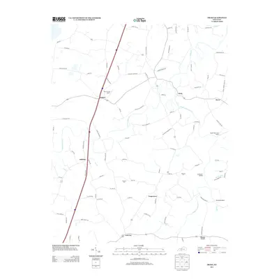
2013 Map of Drake
USGS Topo · Published 2013About this map
Gold City and Temperance anchor this rural landscape in the early twenty-first century, where the winding path of Drakes Cr and its tributaries define the terrain. The map details a web of local roads named for established families and landmarks, such as Ben T Johns Rd and Old Union Church Rd, reflecting the deep-rooted community history of the region. Local aviation is represented by private facilities like Plane-O-Field Airport near Matlock and the Boyce Wafer Farm Airport to the east.
Find a feature on this map
91 named features on this map. Tap any name to fly to it.
Don’t see what you’re looking for? This feature index may not catch every label — zoom into the map to look around manually.
Map Details
Editions of this 2013 Drake Map
This is the sole edition of this map. No revisions or reprints were ever made.
Other maps of this area

1921 · Bowling Green
USGS Topo · 1:62,500

1923 · Bowling Green
USGS Topo · 1:62,500

1928 · Adolphus
USGS Topo · 1:48,000

1931 · Adolphus
USGS Topo · 1:62,500

1942 · Gallatin
USGS Topo · 1:100,000

1951 · Woodburn
USGS Topo · 1:24,000

1951 · Franklin
USGS Topo · 1:24,000

1952 · Rockfield
USGS Topo · 1:24,000

1954 · Drake
USGS Topo · 1:24,000
1954 · Polkville
USGS Topo · 1:24,000