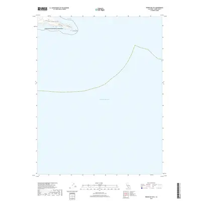
2018 Map of Drakes Bay OE S
USGS Topo · Published 2018About this map
Point Reyes National Seashore is the primary terrestrial feature on this coastal survey, where the rugged Marin County peninsula terminates at Chimney Rock. This particular quadrangle focuses on the narrow southern tip of the headland, providing a detailed look at the interface between the rocky coastline and the Pacific Ocean. Access to this secluded environment is traced via Sir Francis Drake Blvd and Chimney Rock Rd, which lead directly to the bluffs overlooking the waters. The map effectively illustrates the protection of Drakes Bay, showing how the landform creates a sheltered cove against the open sea. Given the limited development within the national seashore, the contours and precise shoreline of the peninsula represent the defining characteristics of this 2018 coastal record.
Find a feature on this map
6 named features on this map. Tap any name to fly to it.
Don’t see what you’re looking for? This feature index may not catch every label — zoom into the map to look around manually.
Map Details
Editions of this 2018 Drakes Bay OE S Map
This is the sole edition of this map. No revisions or reprints were ever made.
Other maps of this area

1916 · Point Reyes
USGS Topo · 1:48,000

1918 · Point Reyes
USGS Topo · 1:62,500

1947 · Santa Rosa
USGS Topo · 1:250,000

1947 · San Francisco
USGS Topo · 1:250,000

1948 · San Francisco
USGS Topo · 1:250,000

1949 · Santa Rosa
USGS Topo · 1:250,000

1953 · Drakes Bay
USGS Topo · 1:24,000
1954 · Inverness
USGS Topo · 1:24,000
1954 · Double Point
USGS Topo · 1:24,000
1954 · Point Reyes
USGS Topo · 1:62,500