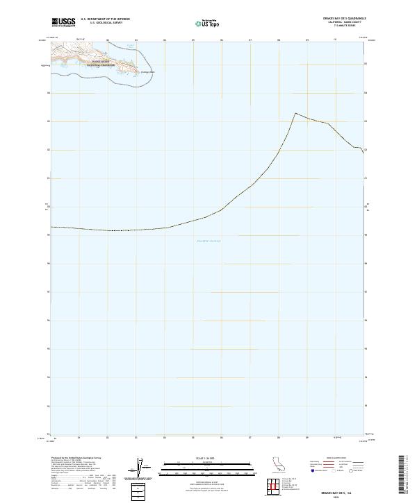
2021 Map of Drakes Bay OE S
USGS Topo · Published 2021About this map
Point Reyes National Seashore defines this coastal landscape where the peninsula's jagged terminus meets the sea. The map focuses on the narrow finger of land leading toward Chimney Rock, a significant topographic landmark that marks the transition between the sheltered waters of Drakes Bay and the open Pacific Ocean. This 2021 topographic record shows the limited road infrastructure required to manage this protected coastal zone, centering on Lighthouse Rd and Chimney Rock Rd. The presence of the Chimney Rock Trl illustrates the emphasis on pedestrian access and conservation in this corner of Marin County. Most of the sheet is dominated by the surrounding marine environment, providing a clear visualization of the coastline's orientation and the relative isolation of these westernmost land features.
Find a feature on this map
7 named features on this map. Tap any name to fly to it.
Don’t see what you’re looking for? This feature index may not catch every label — zoom into the map to look around manually.
Map Details
Editions of this 2021 Drakes Bay OE S Map
This is the sole edition of this map. No revisions or reprints were ever made.
Other maps of this area

1916 · Point Reyes
USGS Topo · 1:48,000

1918 · Point Reyes
USGS Topo · 1:62,500

1947 · Santa Rosa
USGS Topo · 1:250,000

1947 · San Francisco
USGS Topo · 1:250,000

1948 · San Francisco
USGS Topo · 1:250,000

1949 · Santa Rosa
USGS Topo · 1:250,000

1953 · Drakes Bay
USGS Topo · 1:24,000
1954 · Inverness
USGS Topo · 1:24,000
1954 · Double Point
USGS Topo · 1:24,000
1954 · Point Reyes
USGS Topo · 1:62,500