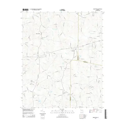
2014 Map of Draketown
USGS Topo · Published 2014About this map
The Tallapoosa River winds through the northern reaches of this Georgia landscape, defining the rural character of the borderlands between Haralson, Paulding, and Carroll Counties. The settlement of Draketown sits as a central hub, surrounded by numerous family and community landmarks that speak to the area's deep-rooted genealogy. Small airstrips like Ayresouth Airport and localized water bodies such as Lake Violet, Foster Lake, and Hatfields Lake are interspersed among a dense network of country roads named for local families, including Oscar Gentry Rd and Virginia Morris Rd. The distribution of sites like Draketown Cem, Corinth Cem, and Piney Woods Cem indicates a long-standing pattern of dispersed agricultural communities. In the south, the terrain is drained by the Little River and Golden Cr, while the crossroads at Piney Woods further emphasizes the historic nature of these upland settlements.
Find a feature on this map
136 named features on this map. Tap any name to fly to it.
Don’t see what you’re looking for? This feature index may not catch every label — zoom into the map to look around manually.
Map Details
Editions of this 2014 Draketown Map
This is the sole edition of this map. No revisions or reprints were ever made.
Other maps of this area

1889 · Tallapoosa
USGS Topo · 1:125,000

1891 · Marietta
USGS Topo · 1:125,000

1892 · Tallapoosa
USGS Topo · 1:125,000

1895 · Marietta
USGS Topo · 1:125,000

1897 · Marietta
USGS Topo · 1:125,000

1897 · Tallapoosa
USGS Topo · 1:125,000

1901 · Marietta
USGS Topo · 1:125,000

1953 · Atlanta
USGS Topo · 1:250,000

1957 · Atlanta
USGS Topo · 1:250,000

1958 · Atlanta
USGS Topo · 1:250,000