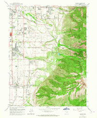
1963 Map of Draper
USGS Topo · Published 1964About this map
Little Cottonwood Creek and Big Cottonwood Cr flow out of the steep eastern canyons to define the developing landscape of the Salt Lake Valley during the early 1960s. The map illustrates a transitional period for Draper and Sandy City, where agriculture and gravel mining meet expanding suburban infrastructure. Notable landmarks of the era include the specialized LDS Church Records Storage Area and the Temple Granite Quarry Historical Monument, marking the site where stone for the Salt Lake Temple was extracted. Aviation history is visible at Alta Airpark and Carters Sky Ranch, while the rail presence is anchored by the Union Pacific line and the Mellen Sand Spur. The map also captures the recreational and spiritual life of the community at the Wasatch Resort and Memorial Gardens of the Valley.
Find a feature on this map
52 named features on this map. Tap any name to fly to it.
Don’t see what you’re looking for? This feature index may not catch every label — zoom into the map to look around manually.
Map Details
Editions of this 1963 Draper Map
Other maps of this area

1885 · Salt Lake
USGS Topo · 1:250,000

1925 · Ft. Douglas
USGS Topo · 1:125,000

1928 · Ft. Douglas
USGS Topo · 1:125,000

1948 · Timpanogos Cave
USGS Topo · 1:24,000

1948 · Orem
USGS Topo · 1:62,500

1950 · Timpanogos Cave
USGS Topo · 1:24,000

1951 · Jordan Narrows
USGS Topo · 1:24,000

1951 · Lehi
USGS Topo · 1:24,000

1951 · Salt Lake City South
USGS Topo · 1:24,000

1951 · Midvale
USGS Topo · 1:24,000