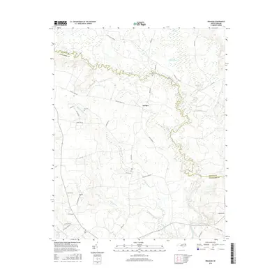
2016 Map of Draughn
USGS Topo · Published 2016About this map
Fishing Creek meanders along the boundary of Halifax and Edgecombe counties, defining the northern landscape of this agricultural region. The unincorporated settlement of Draughn serves as a central point, surrounded by a complex network of wetlands including Beech Swamp, Cow Haul Swamp, and Maple Swamp. These low-lying areas have historically influenced local road patterns, such as Red Hill Church Rd and Draughn Rd, which navigate between the various branches of Moore Swamp and White Oak Swamp.
Find a feature on this map
35 named features on this map. Tap any name to fly to it.
Don’t see what you’re looking for? This feature index may not catch every label — zoom into the map to look around manually.
Map Details
Editions of this 2016 Draughn Map
This is the sole edition of this map. No revisions or reprints were ever made.
Other maps of this area

1901 · Parmele
USGS Topo · 1:62,500

1902 · Parmele
USGS Topo · 1:62,500

1902 · Tarboro
USGS Topo · 1:62,500

1903 · Tarboro
USGS Topo · 1:62,500

1953 · Norfolk
USGS Topo · 1:250,000

1953 · Rocky Mount
USGS Topo · 1:250,000

1954 · Rocky Mount
USGS Topo · 1:250,000

1960 · Dawson Crossroads
USGS Topo · 1:24,000

1960 · Draughn
USGS Topo · 1:24,000

1961 · Whitakers
USGS Topo · 1:24,000