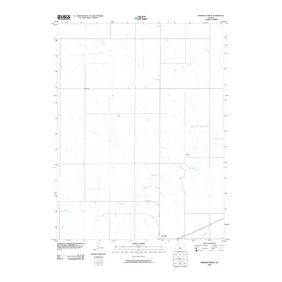
2009 Map of Dresden North
USGS Topo · Published 2009About this map
Dresden anchors the southern edge of this Decatur County landscape, where the High Plains terrain is defined by the winding paths of seasonal waterways. The drainage of Big Timber Creek dominates the northern reaches, while Prairie Dog Creek meanders across the lower half of the quadrangle. This area reflects the grid-based settlement pattern of Western Kansas, with a network of section-line roads such as Co Rd 340 and Co Rd 348 providing access to isolated farmsteads and rural landmarks. Jackson Cemetery stands as a focal point for genealogical interest, located north of the creek in an otherwise sparsely populated region. The map captures the agricultural layout of the early 21st century, illustrating how the rural road network, including County Rd and Co Rd 491, facilitates movement between the town of Dresden and the surrounding prairie.
Find a feature on this map
8 named features on this map. Tap any name to fly to it.
Don’t see what you’re looking for? This feature index may not catch every label — zoom into the map to look around manually.
Map Details
Editions of this 2009 Dresden North Map
This is the sole edition of this map. No revisions or reprints were ever made.
Other maps of this area

1951 · Selden
USGS Topo · 1:62,500

1951 · Oberlin
USGS Topo · 1:62,500

1951 · Kanona
USGS Topo · 1:62,500

1954 · Goodland
USGS Topo · 1:250,000

1956 · Goodland
USGS Topo · 1:250,000

1957 · Goodland
USGS Topo · 1:250,000

1965 · Kanona SE
USGS Topo · 1:24,000

1965 · Oberlin
USGS Topo · 1:24,000

1965 · Kanona
USGS Topo · 1:24,000
1965 · Selden NE
USGS Topo · 1:24,000