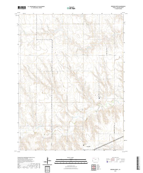
2022 Map of Dresden North
USGS Topo · Published 2022About this map
Dresden anchors the southern edge of this landscape, situated near the headwaters of Prairie Dog Cr. The terrain is defined by the drainage basins of two major watercourses, with the northern sections feeding into Big Timber Cr. This rural Decatur County area is partitioned by a strictly rectangular grid of township roads, including Co RD 340 and 1700th RD, reflecting the enduring legacy of the Public Land Survey System. For those researching local families, two burial sites provide important historical touchstones: Dresden Cem located just outside the town limits and Jackson Cem situated further north. The map illustrates the agricultural character of the High Plains, where human settlement and infrastructure are deeply tied to the subtle shifts in elevation between the creek beds and the surrounding tablelands.
Find a feature on this map
23 named features on this map. Tap any name to fly to it.
Don’t see what you’re looking for? This feature index may not catch every label — zoom into the map to look around manually.
Map Details
Editions of this 2022 Dresden North Map
This is the sole edition of this map. No revisions or reprints were ever made.
Other maps of this area

1951 · Selden
USGS Topo · 1:62,500

1951 · Oberlin
USGS Topo · 1:62,500

1951 · Kanona
USGS Topo · 1:62,500

1954 · Goodland
USGS Topo · 1:250,000

1956 · Goodland
USGS Topo · 1:250,000

1957 · Goodland
USGS Topo · 1:250,000

1965 · Kanona SE
USGS Topo · 1:24,000

1965 · Oberlin
USGS Topo · 1:24,000

1965 · Kanona
USGS Topo · 1:24,000
1965 · Selden NE
USGS Topo · 1:24,000