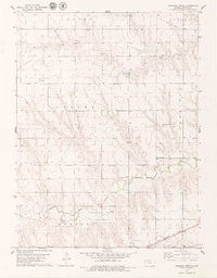
1978 Map of Dresden North
USGS Topo · Published 1979About this map
Big Timber Creek and Prairie Dog Creek meander across this northwest Kansas landscape, carving through the high plains of Decatur County. The township organization is clearly marked, dividing the territory into Altory, Center, Custer, Jennings, Lyon, and Dresden. At the time of this 1970s survey, the regional economy was defined by a mix of agriculture and energy extraction, as evidenced by a designated Oil Field, numerous Oil Wells, and a prominent Pipeline cutting across the northeastern corner. Transportation and infrastructure are anchored by the Chicago Rock Island and Pacific railroad, which runs through the southern section near the community of Dresden. Local history and genealogy interest is concentrated at the Jackson Cem and the small settlement of Custer, while several scattered Wells and a Sandpit indicate the essential water and material resources of the era.
Find a feature on this map
18 named features on this map. Tap any name to fly to it.
Don’t see what you’re looking for? This feature index may not catch every label — zoom into the map to look around manually.
Map Details
Editions of this 1978 Dresden North Map
This is the sole edition of this map. No revisions or reprints were ever made.
Other maps of this area

1951 · Selden
USGS Topo · 1:62,500

1951 · Oberlin
USGS Topo · 1:62,500

1951 · Kanona
USGS Topo · 1:62,500

1954 · Goodland
USGS Topo · 1:250,000

1956 · Goodland
USGS Topo · 1:250,000

1957 · Goodland
USGS Topo · 1:250,000

1965 · Kanona SE
USGS Topo · 1:24,000

1965 · Oberlin
USGS Topo · 1:24,000

1965 · Kanona
USGS Topo · 1:24,000
1965 · Selden NE
USGS Topo · 1:24,000