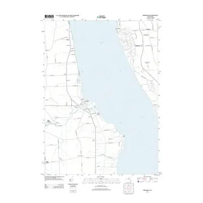
2013 Map of Dresden
USGS Topo · Published 2013About this map
Seneca Lake dominates the center of this landscape, its western shore defined by the village of Dresden and the industrial history of Keuka Lake Outlet. The water flows past Cascade Mills toward the lake, a corridor that historically supported milling and transport. Along the western hills, family and community landmarks such as Evergreen Cem, City Hill Cem, and Hopeton Corners Cem provide vital touchpoints for genealogical research in Milo.
Find a feature on this map
79 named features on this map. Tap any name to fly to it.
Don’t see what you’re looking for? This feature index may not catch every label — zoom into the map to look around manually.
Map Details
Editions of this 2013 Dresden Map
This is the sole edition of this map. No revisions or reprints were ever made.
Other maps of this area

1902 · Geneva
USGS Topo · 1:62,500

1902 · Phelps
USGS Topo · 1:62,500

1902 · Ovid
USGS Topo · 1:62,500

1903 · Penn Yan
USGS Topo · 1:62,500

1942 · Penn Yan
USGS Topo · 1:31,680

1942 · Ovid
USGS Topo · 1:31,680

1942 · Stanley
USGS Topo · 1:31,680

1942 · Dundee
USGS Topo · 1:24,000

1942 · Lodi
USGS Topo · 1:24,000

1942 · Keuka Park
USGS Topo · 1:24,000