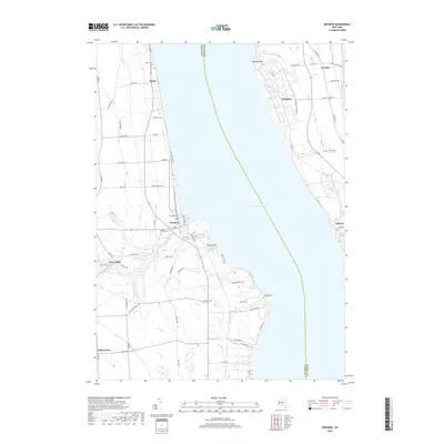
2019 Map of Dresden
USGS Topo · Published 2019About this map
Seneca Lake serves as the central divide of this landscape, separating the townships of Yates and Seneca counties. On the western shore, the village of Dresden marks a significant historical point where the Keuka Lake Outlet enters the larger lake, a waterway that once powered local industry and facilitated transport between the regional lakes. The rural character of the interior is defined by several burial grounds including Evergreen Cem, City Hill Cem, and Hopeton Corners Cem, which offer significant value for genealogists tracing local families near Mays Mills and Milo Center.
Find a feature on this map
68 named features on this map. Tap any name to fly to it.
Don’t see what you’re looking for? This feature index may not catch every label — zoom into the map to look around manually.
Map Details
Editions of this 2019 Dresden Map
This is the sole edition of this map. No revisions or reprints were ever made.
Other maps of this area

1902 · Geneva
USGS Topo · 1:62,500

1902 · Phelps
USGS Topo · 1:62,500

1902 · Ovid
USGS Topo · 1:62,500

1903 · Penn Yan
USGS Topo · 1:62,500

1942 · Penn Yan
USGS Topo · 1:31,680

1942 · Ovid
USGS Topo · 1:31,680

1942 · Stanley
USGS Topo · 1:31,680

1942 · Dundee
USGS Topo · 1:24,000

1942 · Lodi
USGS Topo · 1:24,000

1942 · Keuka Park
USGS Topo · 1:24,000