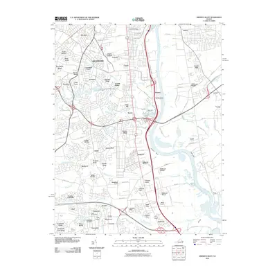
2010 Map of Drewrys Bluff
USGS Topo · Published 2010About this map
James River shipping and industrial expansion define this 2010 landscape south of Richmond. The Deepwater Terminal Port of Richmond and the Southside Station Richmond Post Office serve as major logistical hubs, while the namesake Drewrys Bluff stands over the Kingsland Reach. This era shows a dense network of suburban developments such as Bellwood, Bensley, and Chesterfield Court filling the space between the river and the inland creeks. Local history is preserved in numerous burial grounds, including Cary Cemetery and Saint James Cemetery, which remain amidst the modern transport corridors. Water management is prominent through features like the Falling Creek Filtration Plant Dam and Falling Creek Reservoir, illustrating the infrastructure required to support the growing residential communities of South Garden and Oakland.
Find a feature on this map
128 named features on this map. Tap any name to fly to it.
Don’t see what you’re looking for? This feature index may not catch every label — zoom into the map to look around manually.
Map Details
Editions of this 2010 Drewrys Bluff Map
This is the sole edition of this map. No revisions or reprints were ever made.
Other maps of this area

1890 · Goochland
USGS Topo · 1:125,000

1892 · Goochland
USGS Topo · 1:125,000

1894 · Bermuda Hundred
USGS Topo · 1:62,500

1894 · Richmond
USGS Topo · 1:62,500

1895 · Richmond
USGS Topo · 1:62,500

1897 · Amelia
USGS Topo · 1:125,000

1934 · Seven Pines
USGS Topo · 1:24,000

1934 · Richmond
USGS Topo · 1:24,000

1936 · Richmond West
USGS Topo · 1:24,000

1938 · Dutch Gap
USGS Topo · 1:24,000