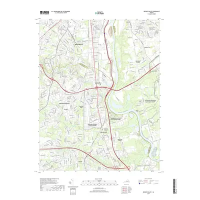
2019 Map of Drewrys Bluff
USGS Topo · Published 2019About this map
The James River snakes through this 2019 survey, defining the industrial and historical corridor between southern Richmond and Chesterfield County. This area is anchored by significant military and commemorative sites, notably the expansive Defense General Supply Center and protected sections of the Richmond National Battlefield Park. The river terrain, marked by Chaffin Bluff and the prominent bend at Kingsland Reach, reflects the strategic importance of the landscape during the Civil War, centered on the heights of Drewrys Bluff.
Find a feature on this map
54 named features on this map. Tap any name to fly to it.
Don’t see what you’re looking for? This feature index may not catch every label — zoom into the map to look around manually.
Map Details
Editions of this 2019 Drewrys Bluff Map
This is the sole edition of this map. No revisions or reprints were ever made.
Other maps of this area

1890 · Goochland
USGS Topo · 1:125,000

1892 · Goochland
USGS Topo · 1:125,000

1894 · Bermuda Hundred
USGS Topo · 1:62,500

1894 · Richmond
USGS Topo · 1:62,500

1895 · Richmond
USGS Topo · 1:62,500

1897 · Amelia
USGS Topo · 1:125,000

1934 · Seven Pines
USGS Topo · 1:24,000

1934 · Richmond
USGS Topo · 1:24,000

1936 · Richmond West
USGS Topo · 1:24,000

1938 · Dutch Gap
USGS Topo · 1:24,000